

About RCS
Building practical rangeland support today and scalable monitoring for tomorrow.
RCS and RMA were born from two linked questions.
First: how do we scale better rangeland management and restoration — with the dissemination, practical support and implementation capacity it needs? That is RCS.
Second: how do we affordably monitor grass use, bush harvesting, restoration and reporting requirements as these activities grow? That is RMA.
Consortium-ready delivery
RCS is built to deliver as part of a consortium. For large institutional assignments, we lead the Namibian rangeland, biomass interpretation, field coordination and practical GIS/mapping components, and work alongside specialist partners for remote sensing, ArcGIS Enterprise geoportal development, drone surveys and technical system integration — with each component led by the appropriate specialist.
RCS - Rangeland Consulting and Services
RCS delivers field-based rangeland consulting, technical support, implementation guidance and project coordination to help land-users, communities and partners restore and manage rangelands sustainably.
Field-based consulting
Practical assessments and advice.
Technical support
Specialist interpretation and guidance.
Implementation guidance
Support for turning plans into action.
Project coordination
Coordination across partners and activities.
Where RCS leads today
Local field presence, landowner and farmer engagement, biomass interpretation, field logistics, GIS/rangeland map outputs and project coordination.
RMA - Rangeland Metrics and Analytics
RMA is the scalable analytics and monitoring platform being built by RCS, combining satellite monitoring, field calibration and AI Rangeland Evaluation to provide affordable, actionable insights across large landscapes.
Satellite monitoring
Landscape-wide observation.
Field calibration
Ground data for accuracy.
AI Rangeland Evaluation
Photo-driven data scaling.
Scalable analytics
Decision support at scale.
How the two fit together
1. Rangeland restoration and management support
RCS works on the ground with farmers, land users and partners to plan, implement and improve rangeland restoration and management.
2. Monitoring and data collection
RMA captures satellite data, calibrates with field observations and applies AI Rangeland Evaluation to generate reliable, scalable insights.
3. Scaled learning and decision support
Insights flow back to the field to improve decisions, demonstrate impact and scale what works across larger landscapes.
Together, RCS and RMA create a continuous loop of action, data and learning for resilient rangelands.
The Core Team
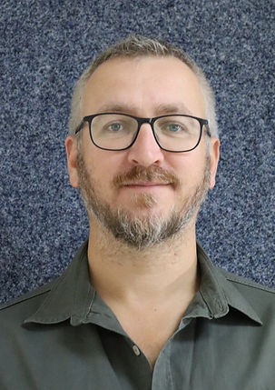
CEO
Evert Strydom
Leads strategy, partnerships and business development, ensuring RCS delivers practical impact and RMA scales responsibly

GIS and Field Data Coordinator
Ndeshihafela Ndapulamo
Coordinates field data collection, GIS workflows and quality assurance to
power reliable rangeland insights through RMA.
Associate experts
Dr Cornelis van der Waal
Ecological Research Advisor. Provides
ecological research expertise to guide
restoration planning and monitoring.
Bertus Kruger
Livestock Management Advisor. Advises on livestock management strategies that support rangeland productivity and resilience.
Sylvia Thompson
GIS Data Analyst Advisor. Supports spatial analysis and remote sensing to turn data into actionable insights.
What we work on
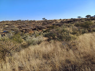
Rangeland assessments
Baseline assessments and condition monitoring.
Monitoring and analytics
Satellite monitoring, field calibration and AI analytics.
Grass monitoring
Forage availability and grazing pressure insights.
Bush quantification
Woody resource mapping for sustainable management.
Technical advisory
Practical guidance on restoration, management and compliance.
Project support
Project coordination, training and capacity building.